Appalachian Trail #1 (MA/VT Border to VT 9)
Appalachian Trail Conservancy
799 West Washington Street
Harpers Ferry, WV 25425
(304) 535-6331

This short but scenic section marks the beginning of the Appalachian Trail in Vermont, where it coincides with the Long Trail. The hike is roughly 14–15 miles long, making it a common 1–2 day segment for section hikers. It starts at the Massachusetts/Vermont state line and trends generally north-northwest through the southern Green Mountains, passing several notable camps and shelters including Seth Warner Shelter, Congdon Shelter, and Ed’s Spring. The terrain is moderately rolling with frequent forested ridges and small drainages, typical of southern Vermont’s mixed hardwood forest. Views are limited in this stretch, but Harmon Hill, just south of VT 9, has one of the most scenic vistas toward Bennington and New York State.
The section ends at Vermont Route 9 east of Bennington, where the trail crosses into the Green Mountain National Forest and the federally designated Glastenbury Wilderness just north of the road. This area is known for its remote feel, dense forests, and wildlife habitat, including black bear. It transitions hikers from the gentler Massachusetts terrain into the more rugged Green Mountains farther north. Overall, this is a relatively easy introduction to Vermont hiking with well-spaced shelters and reliable water sources.
- click for a short video slideshow of my 1994 thru-hike on the Appalachian Trail
- click for more photos from this hike on the A.T. in Vermont: August 22-23, 1994
- click for a Daytimer report from this section of the A.T. in Vermont (password required)
- click for a trail journal from my thru-hike through Vermont (password protected)
- click for a day-by-day summary of BirdShooter’s 1994 Appalachian Trail thru-hike
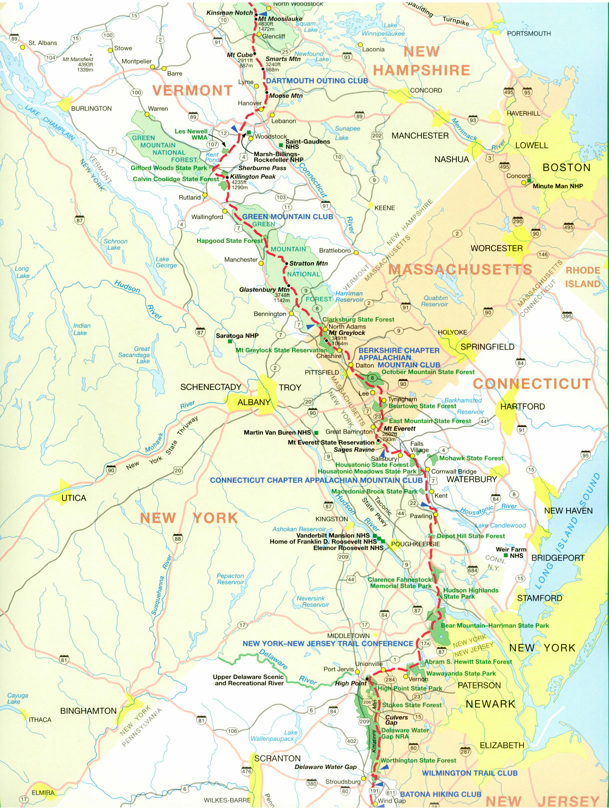
- click for a trail map of the Appalachian Trail in Vermont
- click for a trail map of the entire ~2200 mile Appalachian Trail
- click for the next section of the A.T. in Vermont
- click for the guidebook Appalachian Trail: New Hampshire – Vermont for more hikes in this area
- click for Appalachian Trail hiking and backpacking books
- click for more information on the Appalachian Trail
- click for more hiking and backpacking trips in the State of Vermont