Yellow Branch Falls
Sumter National Forest
Andrew Pickens Ranger District
112 Andrew Pickens Circle
Mountain Rest, South Carolina 29664
(864) 638-9568
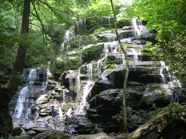
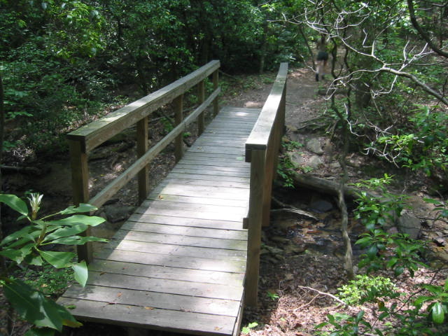
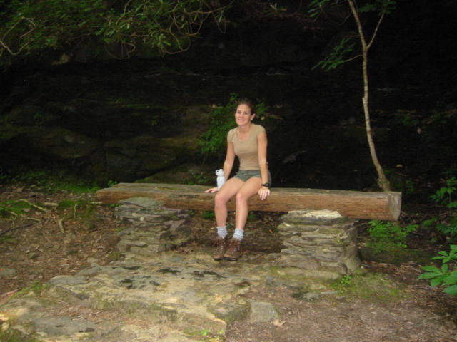
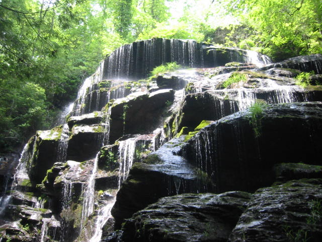
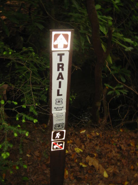
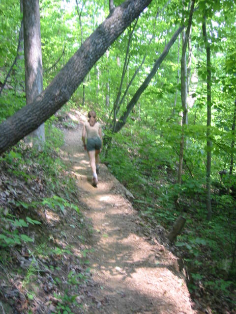
The hike to Yellow Branch Falls is a backtrack hike over moderate terrain that ends at a beautiful 50-foot vertical waterfall with many individual cascades. The hike begins at the picnic area off of SC 28 and follows a connector trail for 0.2 miles and then joins the Yellow Branch Falls Trail for 1.3 miles to the waterfall. On the route you pass through groves of dignified hardwood and meander across a number of streams. In the winter you can see the Town of Walhalla in the distance when the trees are bare. The National Forest Service recommends that you wear sturdy shoes and use extra caution during wet conditions on this hike as the trail skirts the edges of deep ravines.
The best option for camping near Yellow Branch Falls is at the Oconee State Park which is approximately 10 miles away and has 19 cabins, (that sleep four to eight people), 140 campsites, and 10 tent sites. Pets are not allowed in the cabins or in the cabin areas but are permitted in most of the outdoor areas. Check www.southcarolinaparks.com for current rates and restrictions. Pets must also be on a leash no longer than six feet in length. Additional recreational activities at the park include fishing, swimming, and boating in two small lakes.
- click for more photos from this hike to Yellow Branch Falls: May 9, 2004
- click for a detailed trip report for this hike near Oconee State Park: May 9, 2004 (password required)
- click for a trip report of this hike in the northwestern corner of South Carolina (password required)
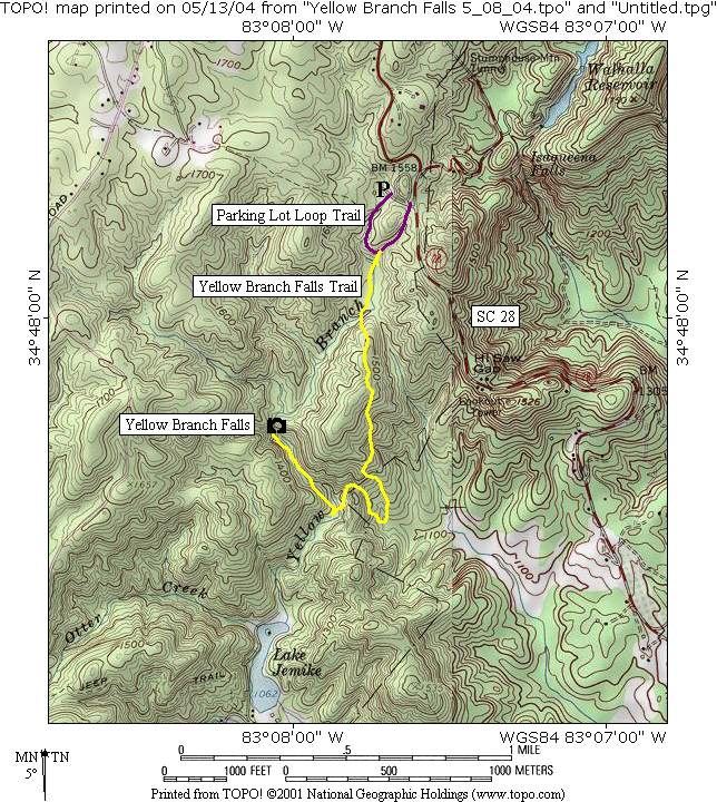
- click for a trail map of this hike to Yellow Branch Falls and the Yellow Branch Picnic Area,
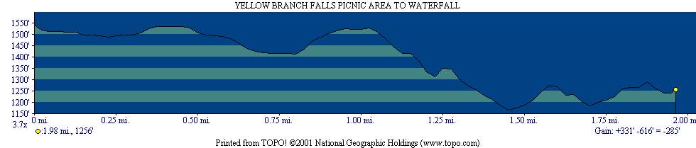
- click for a topographical and profile map of this hike in the Sumter National Forest
- click for the guidebook Best Hikes With Dogs Georgia And South Carolina which has details on this destination
- click for a hike at the nearby Whitewater Falls in North Carolina
- click for South Carolina hiking and backpacking books