Mount LeConte (via Husky Gap to Sugarland)
Great Smoky Mountains National Park
107 Park Headquarters Road
Gatlinburg, TN 37738
(865) 436-1200

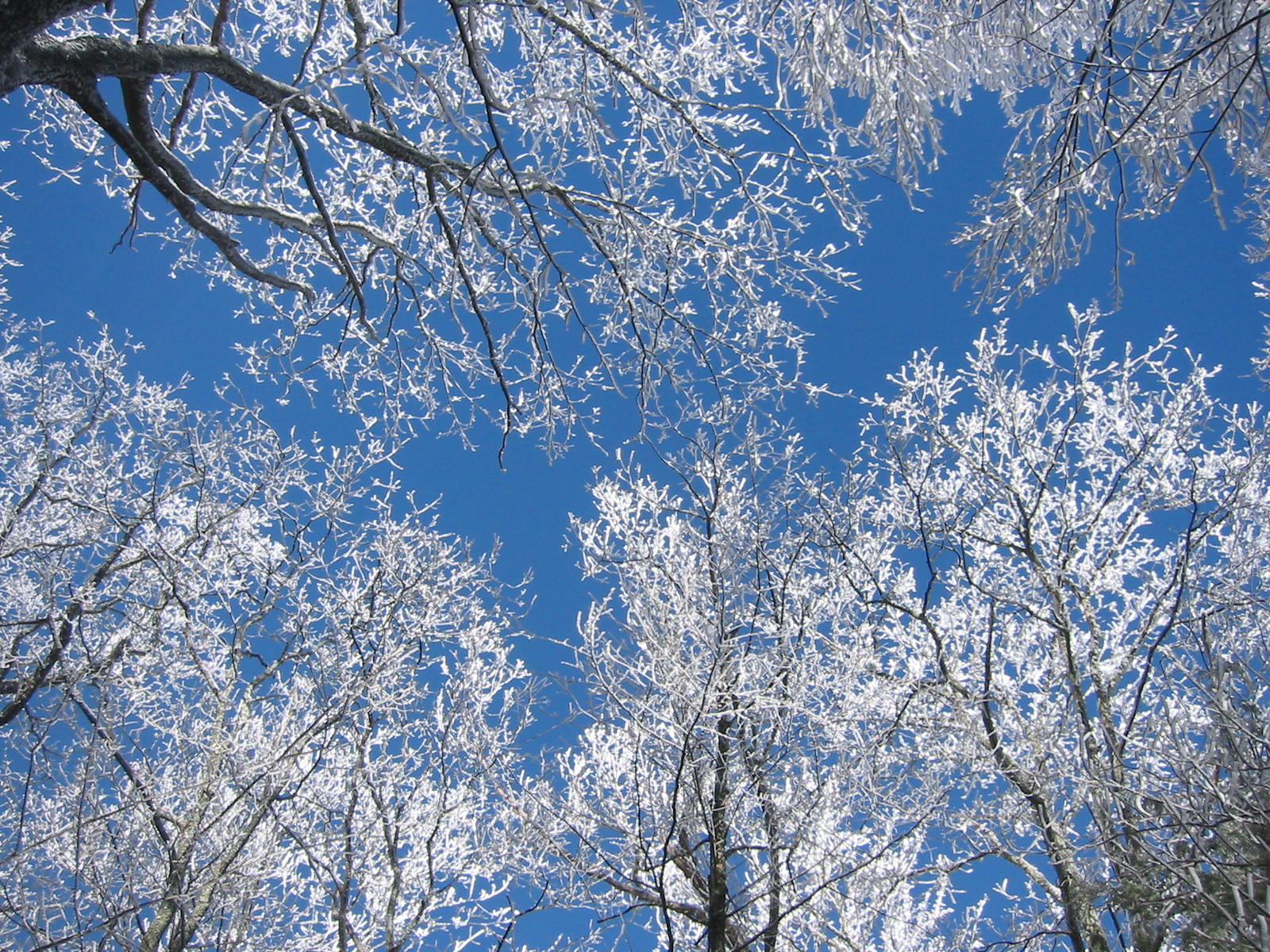
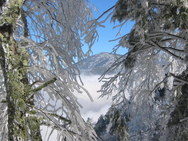
The Great Smoky Mountains National Park stretches across 800 square miles, with nearly 95 percent of its land covered in forest. These ancient mountains, which are among the oldest on Earth, are built from rocks more than 200 million years old with their jagged peaks worn down into the soft, rounded ridges that are present today. These ridgelines are traversed by the Appalachian Trail which climbs to its highest point at Clingmans Dome (6,643 feet) and straddles the border of North Carolina and Tennessee in the park. From the ridges you will often see a distinctive blue haze that lingers over the valleys. It is a natural mist that is created when plants release water vapor and organic compounds into the air which gives the area its trademark “Smoky” Mountains name. Unfortunately, the majority of the people that visit the park never visit the backcountry and see some of the best wilderness in the Southeastern U.S.
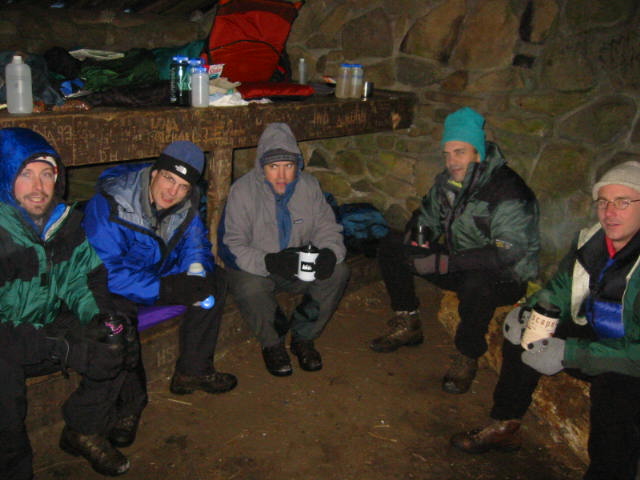
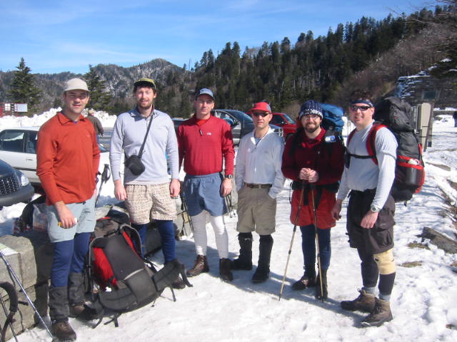
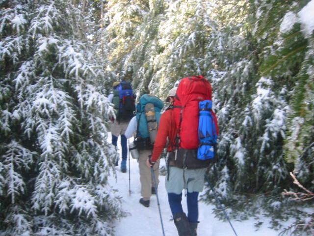
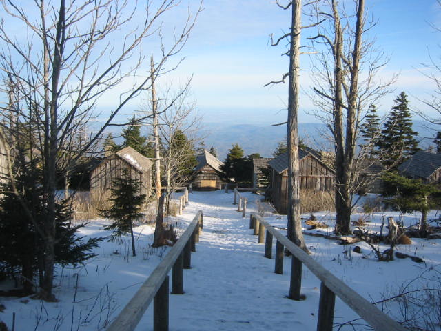
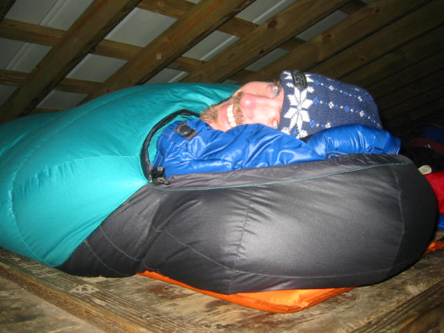
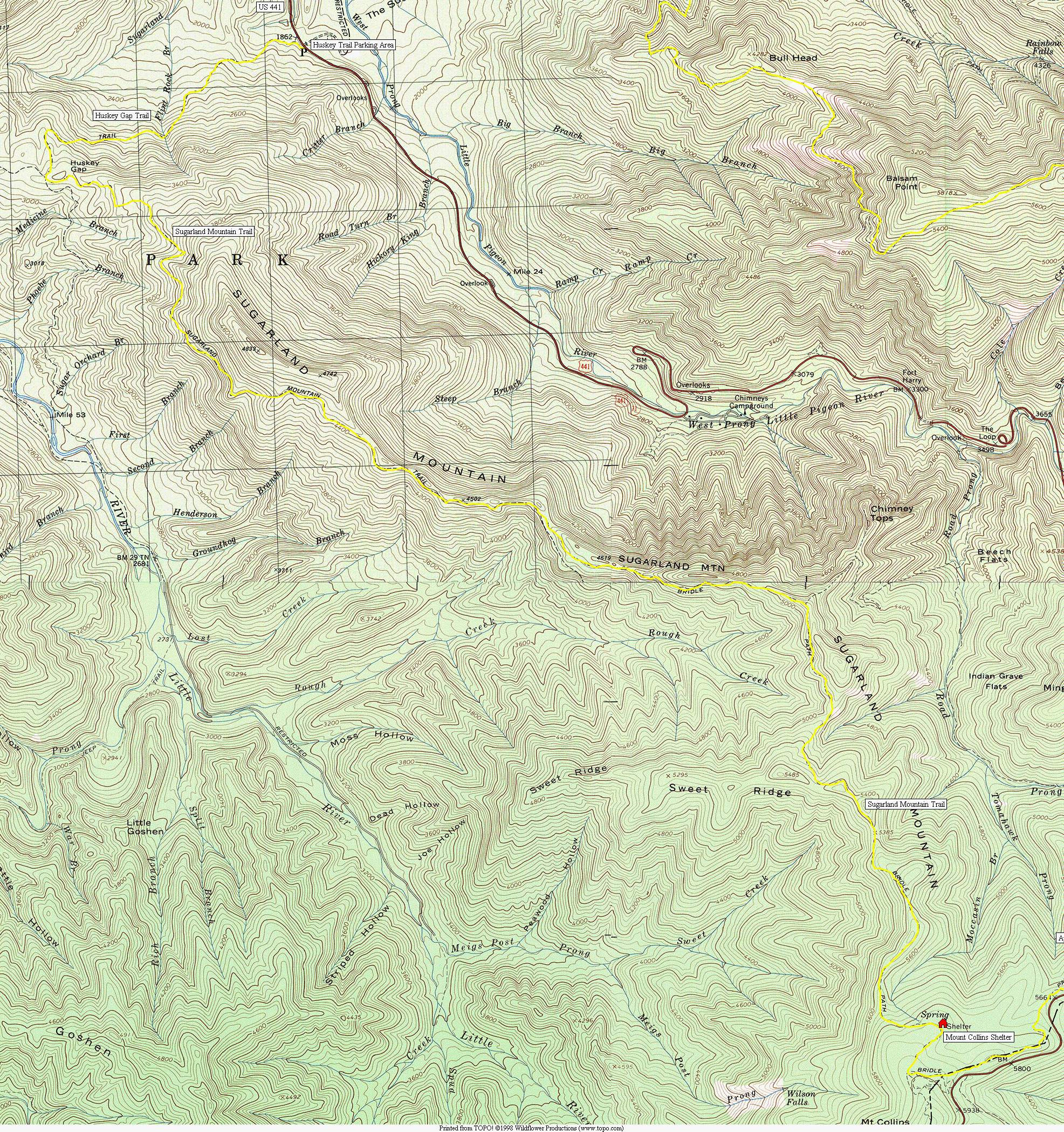
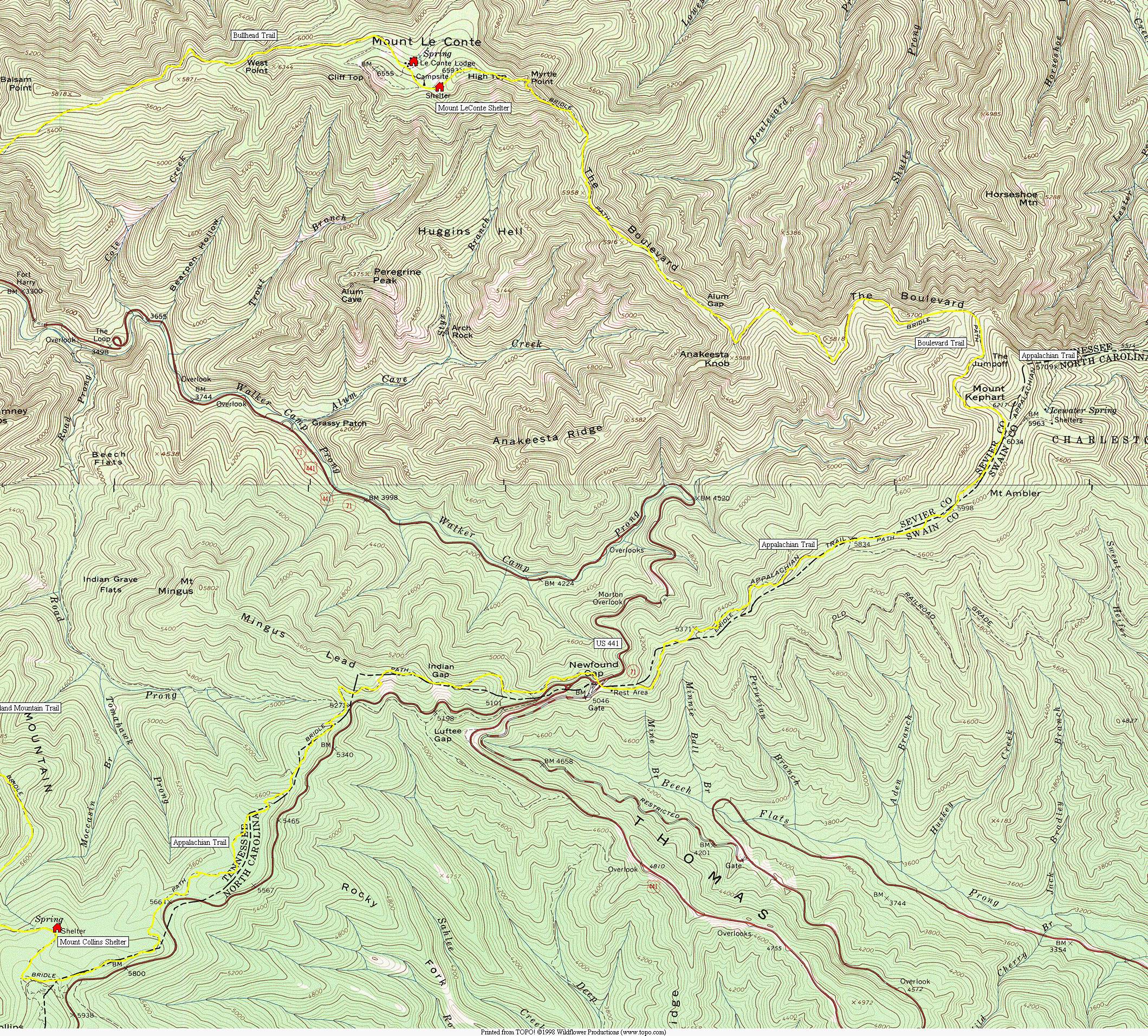
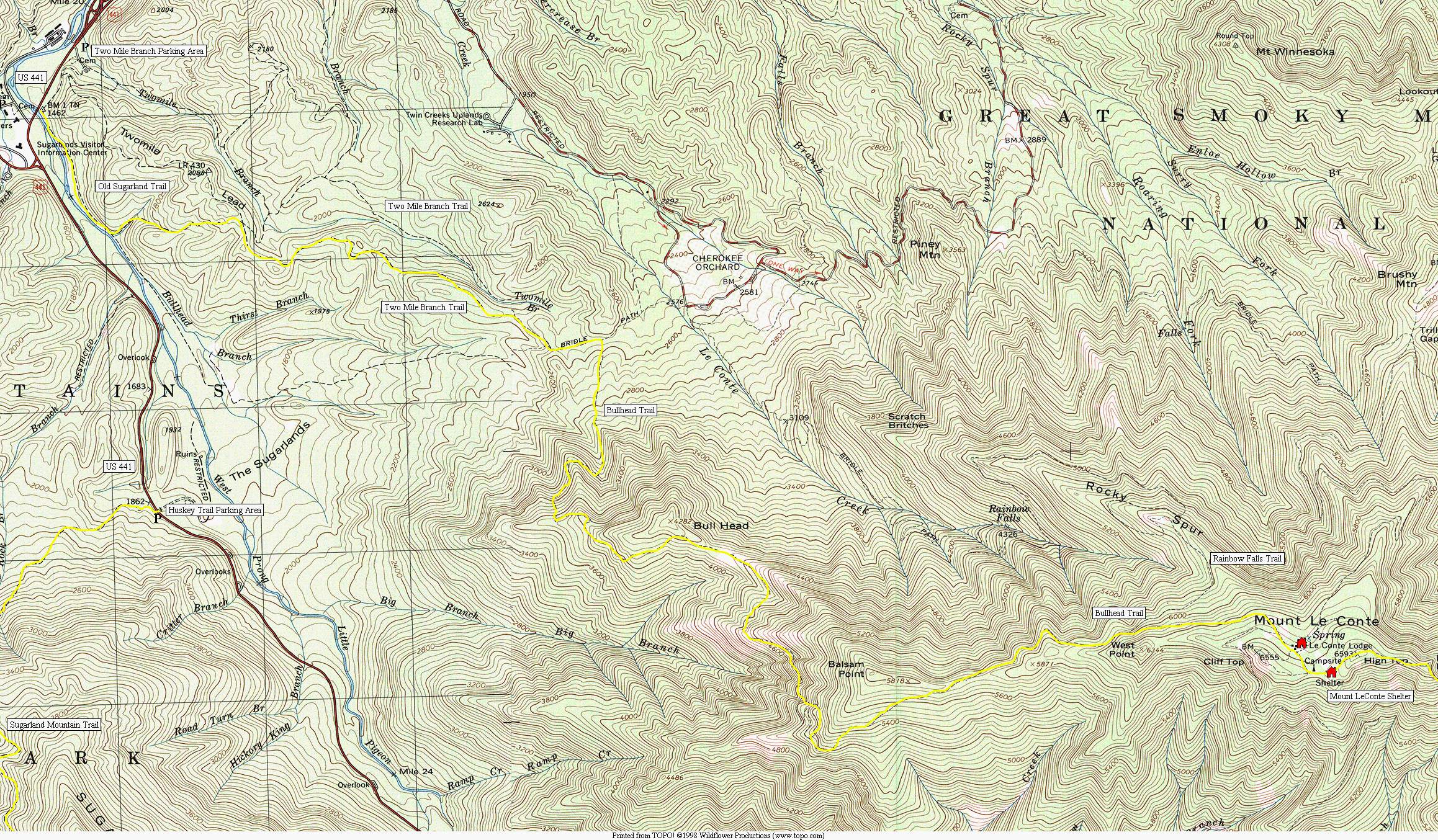
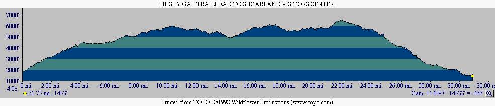
On this hike, we started at US 441 and climbed to the Mount Collins Shelter via the Husky Gap and Sugarland Mountain Trails. Once on the ridge, we followed the Appalachian Trail across Newfound Gap and up to the Boulevard Trail which crosses the summit of Mount LeConte at 6593 feet. There is both a shelter and clustering of commercial buildings available for rent on the mountain, and both Myrtle Point and High Top have spectacular views near the summit. The shortest decent from Mount LeConte is via the Alum Caves Trail, but this route takes the longer and more gradual decent along the Bullhead Trail. It intersects with the Two Mile Branch and Old Sugarlands Trails after 5.9 miles and these trails lead back to an overnight parking area at Sugarland Visitor Center on US 441.
- click for a slideshow from this backpacking trip in the Great Smoky Mountain National Park in February 2005
- click for more photos from this winter hike to Mt. LeConte: February 3-6, 2005
- click for a detailed trip report from this backpacking trip in the Smokies: February 3-6, 2005 (password required)
- click for a trip report from this backpacking trip in the Smokies: February 3-6, 2005 (password required)
- click for a Trails Illustrated map of Great Smoky Mountains National Park
- click for a road and facilities map of Great Smoky Mountains National Park
- click for a trail map of Great Smoky Mountain National Park
- click for a topo map from the Husky Trail parking area to Mount Collins shelter (day one)
- click for a topo map from Mount Collins to the Mount LeConte shelter (day two)
- click for a topo map from Mount LeConte to the Two Mile Branch parking area (day three – Porter route)
- click for a profile map from the Husky Gap trailhead to the Sugarland Visitors Center (Porter route)
- click for a map of some other trails hiked in this area in the Great Smoky Mountains National Park
- click for BirdShooter’s route from this Klondike hike in the Smokies
- click for a list of all our Klondike hikes that date back to the late 90’s (password required)
- click for the guidebook Trail By Trail: Backpacking In The Smoky Mountains which has details on this area