Stratton Bald (via Wolf Laurel Trailhead)
Nantahla National Forest
Cheoah Ranger District
Joyce Kilmer Slickrock Creek Wilderness
Route 1, Box 16-A
Robbinsville, NC 28771
(704) 479-6431
The Joyce Kilmer-Slickrock Creek Wilderness was designated with the passage of the 1975 Wilderness Act and later expanded in 1984 through the North Carolina Wilderness Act, helping preserve one of the largest remaining stretches of old-growth forest in the southern Appalachian Mountains. Covering 17,013 rugged acres, the wilderness shares a remote mountain boundary along the Unicoi Mountains with the Citico Creek Wilderness in the Cherokee National Forest, creating an enormous backcountry landscape that spans both North Carolina and Tennessee. Most of the wilderness lies within the Nantahala National Forest, an area known for steep ridges, deep creek valleys, and exceptionally high rainfall that supports dense hardwood forests and rich biodiversity. The wilderness is crisscrossed by miles of primitive trails that follow old logging grades, mountain streams, and narrow ridgelines, offering hikers a true backcountry experience with minimal development and few modern conveniences. Slickrock Creek, Little Slickrock Creek, and numerous smaller streams carve through the landscape, creating waterfalls, cascades, and remote swimming holes throughout the wilderness.
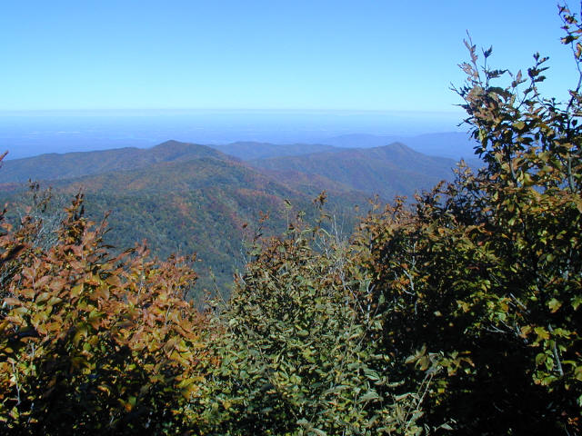
Although the wilderness is best known for the towering stands of virgin timber in the Poplar Cove area — including massive tulip poplars, maples, and hemlocks that escaped the logging boom of the early 1900s — the high-elevation balds and ridges provide some of the most spectacular mountain scenery in the region. Stratton Bald rises to 5,360 feet and features a broad grassy meadow surrounded by spruce and hardwood forest, while nearby The Hangover is famous for its dramatic rocky cliffs and sweeping 270-to-360-degree panoramas across the Cherokee and Nantahala National Forests. On clear days, hikers can see layer after layer of blue Appalachian ridges stretching deep into both Tennessee and North Carolina. The hike to Stratton Bald is considered a moderate but relatively short trek that begins at the Wolf Laurel Trailhead and steadily climbs through quiet forest before emerging onto the open summit meadow. In spring and summer the bald is covered in wildflowers and tall grasses, while autumn brings vibrant foliage colors across the surrounding mountains. The combination of old-growth forests, remote wilderness terrain, and expansive mountaintop views makes this one of the premier backpacking and hiking destinations in the southern Appalachians.
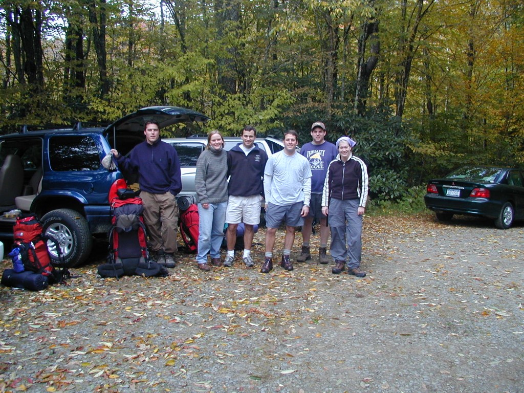
- click for more photos from this hike in Joyce Kilmer-Slickrock Creek Wilderness: October 6, 2001
- click for a photo journal from this backpacking trip to Bob Stratton Bald: October 6, 2001
- click for a detailed trip report for this hiking trail to Stratton Bald: October 6, 2001 (password required)
- click for a trip report of this hike in the Nantahala National Forest: October 6, 2001 (password required)
- click for the Fontana and Hiwassee Lakes Trails Illustrated Map which has details of this area
- click for a topo and profile map of this backpacking trip to Stratton Bald (password required)
- click for a Trails Illustrated map with multiple access points to this area (password required)
- click for another hike to Bob Stratton Bald in October 2013
- click for a hike in the valley of the Joyce-Kilmer Slickrock Creek Wilderness in August 2004
- click for a hike to the nearby Hangover rock outcropping in November 2002
- click for the guidebook Hiking Trails of Joyce Kilmer-Slickrock And Citico Creek Wilderness
- click for other North Carolina hiking and backpacking books