Leaf Lake
Huron-Manistee National Forest
Supervisor’s Office
1755 S. Mitchell Street
Cadillac, MI 49601
800-821-6263
231-775-2421

The Huron-Manistee National Forests has over 330 miles of trails, some of which are shared with horses or cross-country skiers in the winter months. The hiking and horse trails are often linear, while the cross-country and interpretive (nature) trails are usually loops of varied lengths. The North Country National Scenic Trail (NST) is a linear trail that passes through a portion of the Huron-Manistee National Forest and links outstanding scenic, natural, recreational, historic, and cultural areas in seven of the northern States-New York, Pennsylvania, Ohio, Michigan, Wisconsin, Minnesota, and North Dakota.
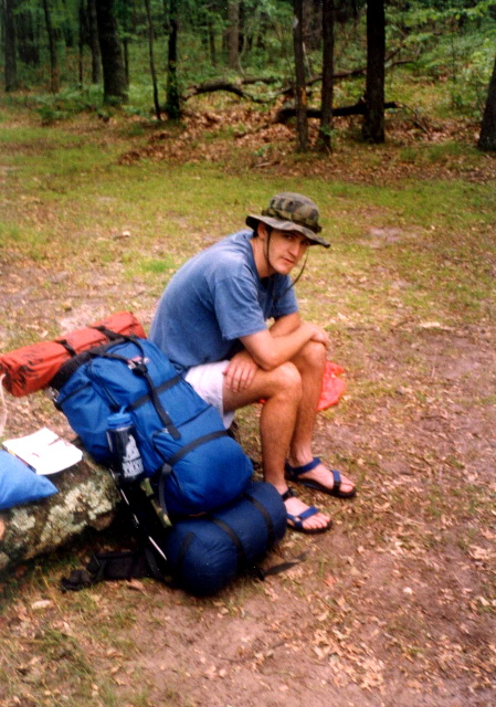
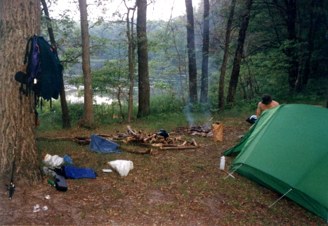
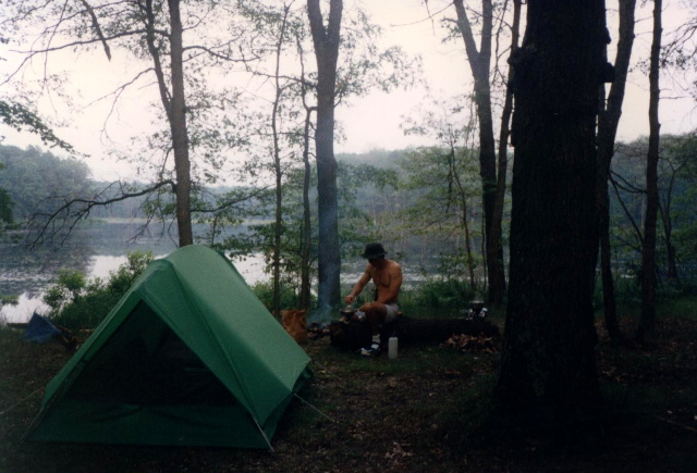
Leaf Lake sits within the Manistee portion of the Huron‑Manistee National Forests in northern Michigan. It’s a scenic destination along the North Country National Scenic Trail (NCT) and draws campers, hikers, and anglers to its tranquil waters. We spent two days on the NST and hiked to a series of lakes both north and south of Leaf Lake in the Manistee National Forest. The skeeters were vicious but the scenery and fishing were excellent. You can reach Leaf Lake via the NCT, starting near Nichols Lake. A common hike is an ~8‑mile moderate out‑and‑back or loop encompassing Leaf, Nichols, Condon, and Sawkaw Lakes. There are primitive/backcountry campsites near Leaf Lake and adjacent lakes like Sawkaw and Nichols, offering rustic lakeside camping,
- click for more photos from this backpacking trip to Leaf Lake: July 1, 1993
- click for a trip report from this hike in the Huron-Manistee National Forest: July 1, 1993 (password required)
- click for a Daytimer report from this backpacking trip on the North Country Trail: July 1, 1993 (password required)
- click for a trail map with notes from this hike to Condor Lake
- click for a topographical and profile map of this hike to Leaf Lake (password required)
- click for another backpacking trip in Michigan at Isle Royal
- click for the guidebook Hiking Michigan for more hikes in this area
- click for links to other outdoor books and magazines
- click for more hikes in the State of Michigan