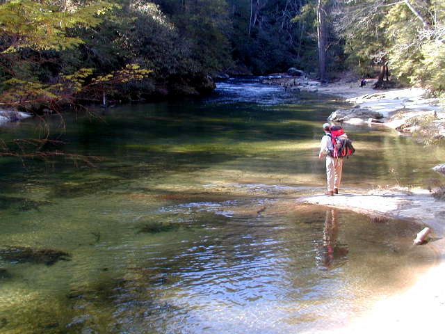
HIGHLIGHTS: The Chattooga River Trail is a forty mile route that borders the states of North Carolina, South Carolina, and Georgia and follows the banks of the Chattooga National Wild And Scenic River from Burrell’s Ford to US 76. Congress designated the river on May 10, 1974 and it is often used by kayakers, hikers, backpackers, and fisherman as it winds down from the North Carolina mountains. The Chattooga River Trail shares its pathway with both the Foothills and Bartram Trails in the Russell Bridge area, but it stays close to the river for its entire distance unlike the other major southeastern trails. The Chattooga River (which is occasionally misspelled the Chatooga River or the Chattoga River) begins in the mountains of North Carolina as small rivulets, nourished by springs and abundant rainfall, high on the slopes of the Appalachian Mountains. The water drops a half mile in elevation over fifty miles as it winds its way to Lake Tugaloo where the river ends between South Carolina and Georgia. The Chattooga is one of the few remaining free-flowing streams in the Southeast, and the setting is primitive with dense forests and undeveloped shorelines on most of its route. On May 10, 1974, Congress designated the Chattooga a Wild and Scenic River – a honor reserved for rivers with outstanding scenery, recreation, wildlife, geologic, and cultural values. The trails in North Carolina are short, and pass steep cliffs near the headwaters of the Chattooga. In this area, there are cascading falls with sandbars and quiet pools which are ideal spots for picnicking and swimming. In South Carolina, the trails are longer and extend from Ellicott Rock to SC Highway 28. The hiker is exposed to every facet of the river environment: deep coves, rapids, and ridge lines in the state. It takes about two days to hike the nineteen miles of trail in South Carolina. MORE DETAILS |
Speak Your Mind